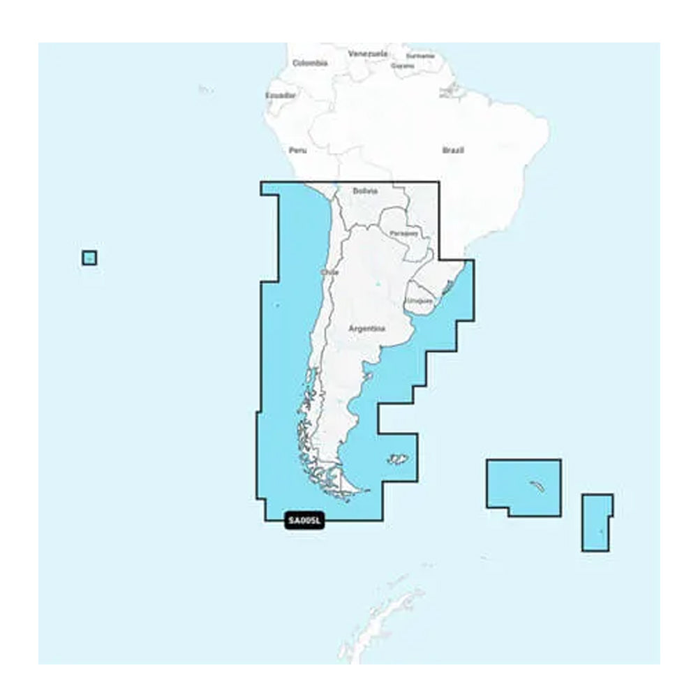
Garmin Navionics+ NSSA005L - Chile, Argentina Easter Island - Marine Chart
Garmin Navionics+ NSSA005L - Chile, Argentina Easter Island - Marine Chart is backordered and will ship as soon as it is back in stock.
Product Description
Product Description
Navigate the coastal waters of South America with the Navionics+™ NSSA005L Marine Chart, designed for Chile, Argentina, and Easter Island. Experience the highest quality, most up-to-date marine mapping available, ensuring you have the best tools for safe and efficient boating.
Coverage Area
The Navionics+ NSSA005L offers comprehensive coastal coverage of South America, spanning from Arica, Chile to Rio Grande, Brazil. It also includes detailed mapping of distant locations such as Easter Island, Cape Horn, the Falkland Islands/Islas Malvinas, the South Georgia Islands, the South Sandwich Islands, and the Rio de la Plata.
Key Features
- All-in-One Map Solution: Access detailed mappings of coastal features, lakes, rivers, and more. Integrated content from Garmin and Navionics® ensures worldwide coverage for boaters.
- Daily Chart Updates: Stay current with up to 5,000 updates made every day. Your purchase includes a one-year subscription granting access to these daily updates through the ActiveCaptain app.
- Auto Guidance+ Technology: Benefit from Garmin and Navionics' combined automatic routing features. The built-in Auto Guidance+ technology suggests optimal dock-to-dock paths through channels, inlets, marina entrances, and other areas.
- Depth Range Shading: Customize your depth visualization with up to 10 color-shaded target depth ranges, making it easy to identify ideal fishing spots at a glance.
- Up to 1' Contours: Enhance your navigation and fishing experience with high-resolution depth contours, providing a clear depiction of bottom structures in swamps, canals, harbors, marinas, and more.
- Shallow Water Shading: Avoid shallow waters effortlessly with user-defined depth shading, ensuring safe passage through tricky areas.
- ActiveCaptain Community: Leverage community-sourced points of interest (POIs) such as marinas, anchorages, hazards, and businesses. Receive recommendations from experienced boaters familiar with the local environment.
Subscription Details
When you purchase the Garmin Navionics+ or Garmin Navionics Vision+ cartography product, a one-year subscription is included. This subscription grants access to daily chart updates through the ActiveCaptain app, ensuring your marine charts are always up-to-date.
Technical Specifications
| Format | MicroSD/SD Card |
|---|
In the Box
- SD/MSD Card
Chart Code: NSSA005L
Compatibility
- Check the compatibility of Garmin Navionics+ content and features with your GPS chartplotter.
1 Auto Guidance+ is for planning purposes only and does not replace safe navigation operations.
*Sold as an Individual
Delivery and Shipping
Delivery and Shipping
Orders of physical products placed by 3 PM EST M-F typically ships the same day, if all requested items are in stock. Weekend orders will typically ship on Monday.
Shipping takes 2-7 days.
We currently ship to the Contiguous 48 States.
Life of Sailing merch is custom made for the customer after an order is placed. Total turnaround is typically 7-14 days from order to doorstep.
Payment & Security
Payment methods
Your payment information is processed securely. We do not store credit card details.

