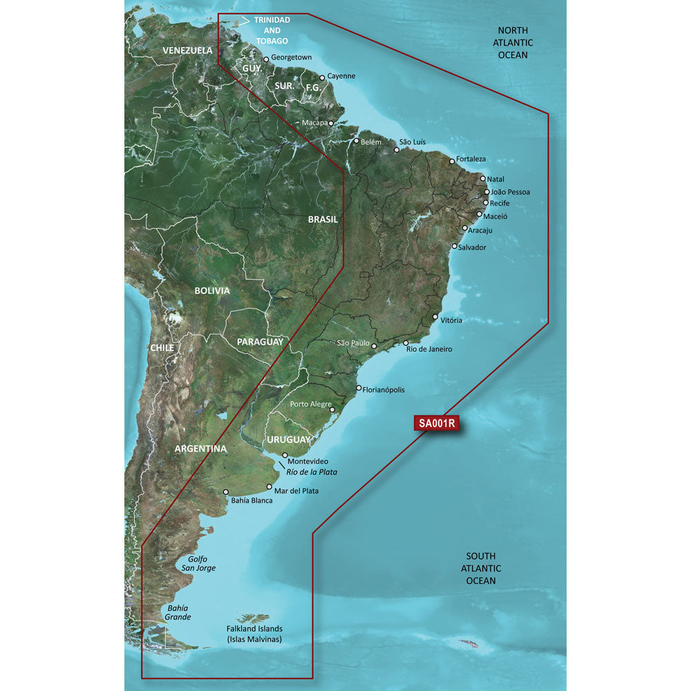
Garmin BlueChart g3 HD - HXSA001R - South America East Coast - microSD/SD
Garmin BlueChart g3 HD - HXSA001R - South America East Coast - microSD/SD is backordered and will ship as soon as it is back in stock.
Product Description
Product Description
The Garmin BlueChart® g3 HD - HXSA001R is your ultimate navigation solution for exploring the vast and diverse East Coast of South America. Whether you're charting a course through bustling harbors or navigating serene canals, this high-definition charting tool ensures precision and reliability for every marine adventure.
Product Overview
The Garmin BlueChart® g3 HD - HXSA001R is designed specifically for the South America East Coast, providing comprehensive coverage from the Golfo de Paria to Tierra del Fuego. Compatible with both microSD™ and SD™ cards, this chart offers seamless integration with your Garmin device, delivering detailed and reliable maps for enhanced navigation.
Extensive Coverage Area
Explore a wide range of waterways and coastal regions with the Garmin BlueChart® g3 HD. Key areas covered include:
| Region | Details |
|---|---|
| Trinidad and Tobago | Comprehensive maps of major ports and coastal areas. |
| Lago de Brasilia | Detailed shoreline and depth information. |
| Rio de la Plata | Extensive coverage of riverine navigation routes. |
| Rio Uruguay to Salto, Uruguay | Accurate mapping of riverbanks and navigation channels. |
| Rio Parana to Parana, Argentina | Enhanced detail for safe passage and anchorage. |
| Falkland Islands (Islas Malvinas) | High-definition charts for remote and challenging waters. |
Advanced Navigational Features
Harness the power of advanced navigation tools to enhance your boating experience:
- Comprehensive Data Sources: Charts derived from official and private sources, offering navigational aids, spot soundings, tides, currents, and detailed harbor and marina information.
- Depth Range Shading: Visualize up to 10 depth ranges simultaneously, allowing for quick identification of target depths.
- Shallow Water Shading: Customize depth shading levels to navigate safely through shallow areas.
Enhanced Depth Visualization
Understanding your marine environment is crucial. The BlueChart® g3 HD provides:
- High-Resolution Depth Shading: Display up to 10 depth ranges with precision, enabling you to assess underwater terrain at a glance.
- 1-Foot Contours: Gain a more accurate depiction of the bottom structure, essential for fishing enthusiasts and those navigating complex waterways.
Accurate Bottom Mapping
Navigate with confidence using detailed bottom maps:
- Improved Fishing Charts: Identify optimal fishing spots with precise depth and underwater structure information.
- Enhanced Navigation in Challenging Areas: Safely traverse swamps, canals, and marinas with detailed contour lines and depth information.
Safety and Compliance
 WARNING: This product can expose you to chemicals which are known to the State of California to cause cancer, birth defects, or other reproductive harm. For more information, visit P65Warnings.ca.gov.
Return Policy: This product may not be returned to the original point of purchase. Please contact the manufacturer directly with any issues or concerns.
Support and Resources
Ensure you have all the information you need with the comprehensive Owner's Manual:
Delivery and Shipping
Delivery and Shipping
Orders of physical products placed by 3 PM EST M-F typically ships the same day, if all requested items are in stock. Weekend orders will typically ship on Monday.
Shipping takes 2-7 days.
We currently ship to the Contiguous 48 States.
Life of Sailing merch is custom made for the customer after an order is placed. Total turnaround is typically 7-14 days from order to doorstep.
Payment & Security
Payment methods
Your payment information is processed securely. We do not store credit card details.


