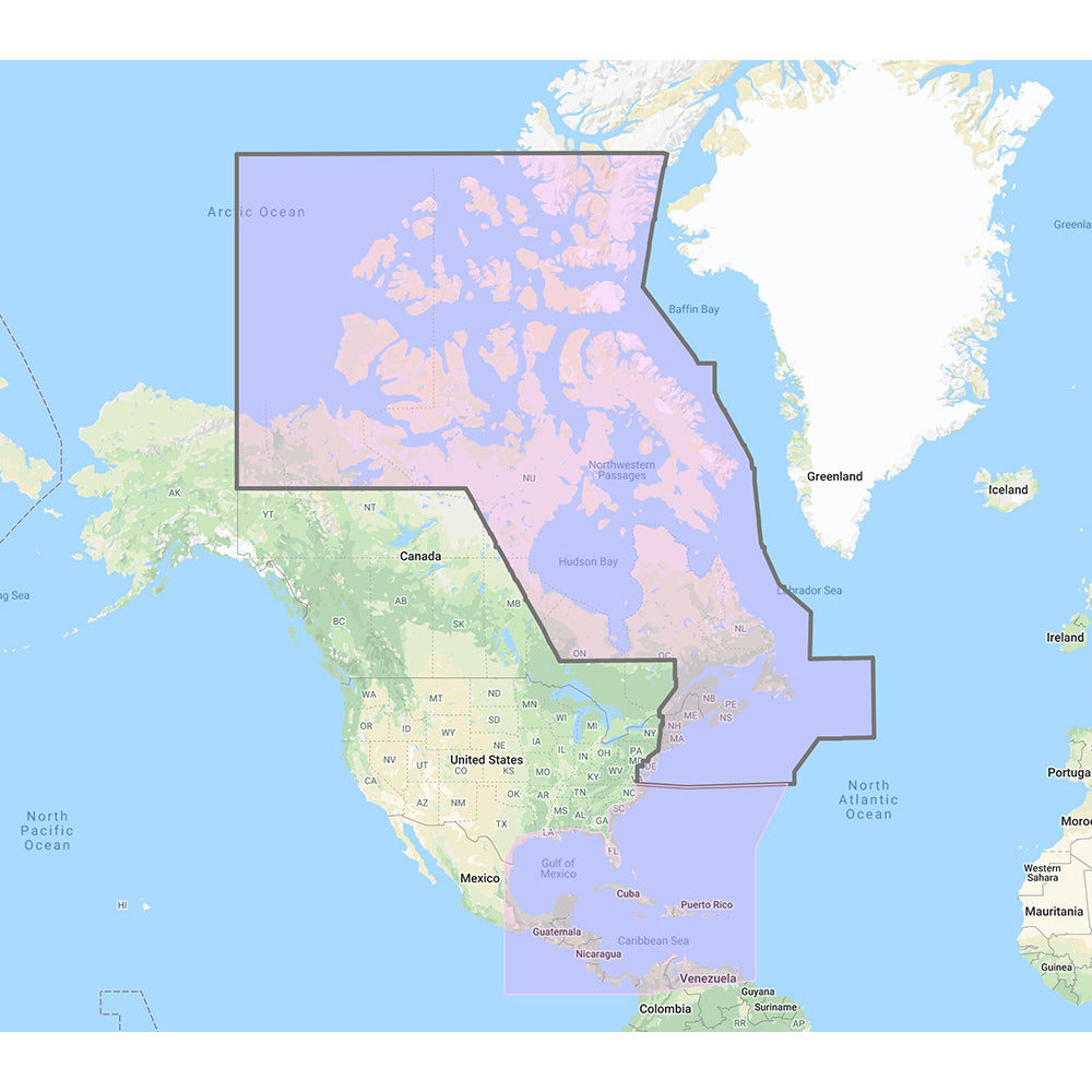
Furuno US Canada Atlantic Coast, Gulf of Mexico, Caribbean Bahamas and central America Vector Charts - Unlock Code
Furuno US Canada Atlantic Coast, Gulf of Mexico, Caribbean Bahamas and central America Vector Charts - Unlock Code is backordered and will ship as soon as it is back in stock.
Product Description
Product Description
Enhance your marine navigation experience with our comprehensive C-Map Mega Wide Chart Pack. This essential navigation tool provides detailed vector charts, immersive 3D data, and high-quality standard resolution satellite photographs covering the U.S. and Canadian Atlantic Coast, Gulf of Mexico, Caribbean, Bahamas, and Central America. Perfect for boaters and maritime enthusiasts, these charts ensure accurate and reliable navigation across some of the most popular and challenging waters.
Features
- Comprehensive Coverage: Includes detailed maps of the U.S. & Canada Atlantic Coast, Gulf of Mexico, Caribbean, Bahamas, and Central America.
- Vector Charts: Crisp and clear vector-based maps for easy navigation and route planning.
- 3D Data: Realistic three-dimensional representations of the seafloor and coastal features for enhanced situational awareness.
- Satellite Imagery: Standard resolution satellite photos provide a real-world view of your surroundings.
- TimeZero Compatible: Converted to the TimeZero format for seamless integration with your navigation systems.
- High Quality: Equivalent cartographic information found in C-MAP MAX and C-MAP MAX PRO charts.
Compatibility
This chart pack is fully compatible with the following Furuno navigation systems:
- NavNet 3D
- TZT
- TZT2
How to Purchase
To acquire the C-Map Mega Wide Chart Pack, follow these simple steps:
- Locate Your System ID: Navigate to the “My NavNet” menu on your Furuno device to find your unique System ID.
- Contact Your Dealer: Provide your System ID to your local authorized Furuno dealer.
- Receive Unlock Code: Upon purchase, you will receive an unlock code to access and download your chart pack.
Product Specifications
| Region Coverage | Data Types | Compatibility |
|---|---|---|
| U.S. & Canada Atlantic Coast, Gulf of Mexico, Caribbean, Bahamas, Central America | Vector Charts, 3D Data, Standard Resolution Satellite Photos | NavNet 3D, TZT, TZT2 |
Legal Notice
 WARNING: This product can expose you to chemicals which are known to the State of California to cause cancer, birth defects, or other reproductive harm. For more information, visit P65Warnings.ca.gov.
Delivery and Shipping
Delivery and Shipping
Orders of physical products placed by 3 PM EST M-F typically ships the same day, if all requested items are in stock. Weekend orders will typically ship on Monday.
Shipping takes 2-7 days.
We currently ship to the Contiguous 48 States.
Life of Sailing merch is custom made for the customer after an order is placed. Total turnaround is typically 7-14 days from order to doorstep.
Payment & Security
Payment methods
Your payment information is processed securely. We do not store credit card details.

