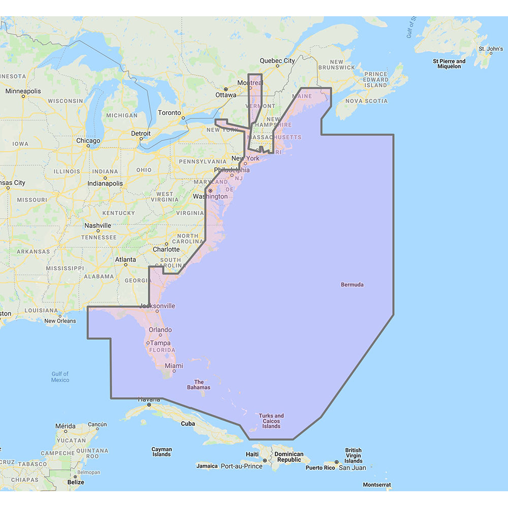
Furuno U.S. East Coast, Bahamas Bermuda - Vector Charts Standard Resolution Satellite Photos f/Bahamas - Unlock Code
Furuno U.S. East Coast, Bahamas Bermuda - Vector Charts Standard Resolution Satellite Photos f/Bahamas - Unlock Code is backordered and will ship as soon as it is back in stock.
Product Description
Product Description
Enhance your marine navigation with our comprehensive Chart Pack, featuring detailed vector charts for the U.S. East Coast, Bahamas, and Bermuda, alongside standard resolution satellite photos for the Bahamas. This essential tool ensures you have accurate and reliable charting information for a seamless boating experience.
Product Features
- Comprehensive Coverage: Detailed vector charts covering the United States East Coast, Bahamas, and Bermuda.
- High-Quality Satellite Imagery: Standard resolution satellite photographs for the Bahamas, providing a clear view of the area.
- Accurate Cartography: Utilizes the same cartographic data found in C-MAP MAX and C-MAP MAX PRO charts for consistency and reliability.
Included Contents
| Region | Type | Description |
|---|---|---|
| U.S. East Coast | Vector Charts | Detailed navigational charts for the United States East Coast. |
| Bahamas | Vector Charts & Satellite Photos | Comprehensive vector charts and standard resolution satellite images. |
| Bermuda | Vector Charts | Accurate navigational charts for Bermuda waters. |
Compatibility
This Chart Pack is compatible with the following Furuno navigation systems:
- NavNet 3D
- TZT
- TZT2
Ensure your system is up-to-date to take full advantage of the chart data provided.
Unlock Code Information
System ID Number is Required to Receive an Unlock Code
To access and view the chart data, an unlock code must be purchased. Follow these steps to obtain your unlock code:
- Locate your NavNet system ID in the “My NavNet” menu of your navigation system.
- Provide your system ID to your local authorized Furuno dealer.
- Complete the purchase of the unlock code through your dealer.
Once you have the unlock code, enter it into your navigation system to activate and view the chart data.
Additional Information
These C-MAP charts offer the same high-quality cartographic information as found in premium C-MAP MAX and C-MAP MAX PRO charts, ensuring reliability and accuracy for your maritime navigation needs.
Safety Information
 WARNING: This product can expose you to chemicals which are known to the State of California to cause cancer, birth defects, or other reproductive harm. For more information, visit P65Warnings.ca.gov.
Delivery and Shipping
Delivery and Shipping
Orders of physical products placed by 3 PM EST M-F typically ships the same day, if all requested items are in stock. Weekend orders will typically ship on Monday.
Shipping takes 2-7 days.
We currently ship to the Contiguous 48 States.
Life of Sailing merch is custom made for the customer after an order is placed. Total turnaround is typically 7-14 days from order to doorstep.
Payment & Security
Payment methods
Your payment information is processed securely. We do not store credit card details.

