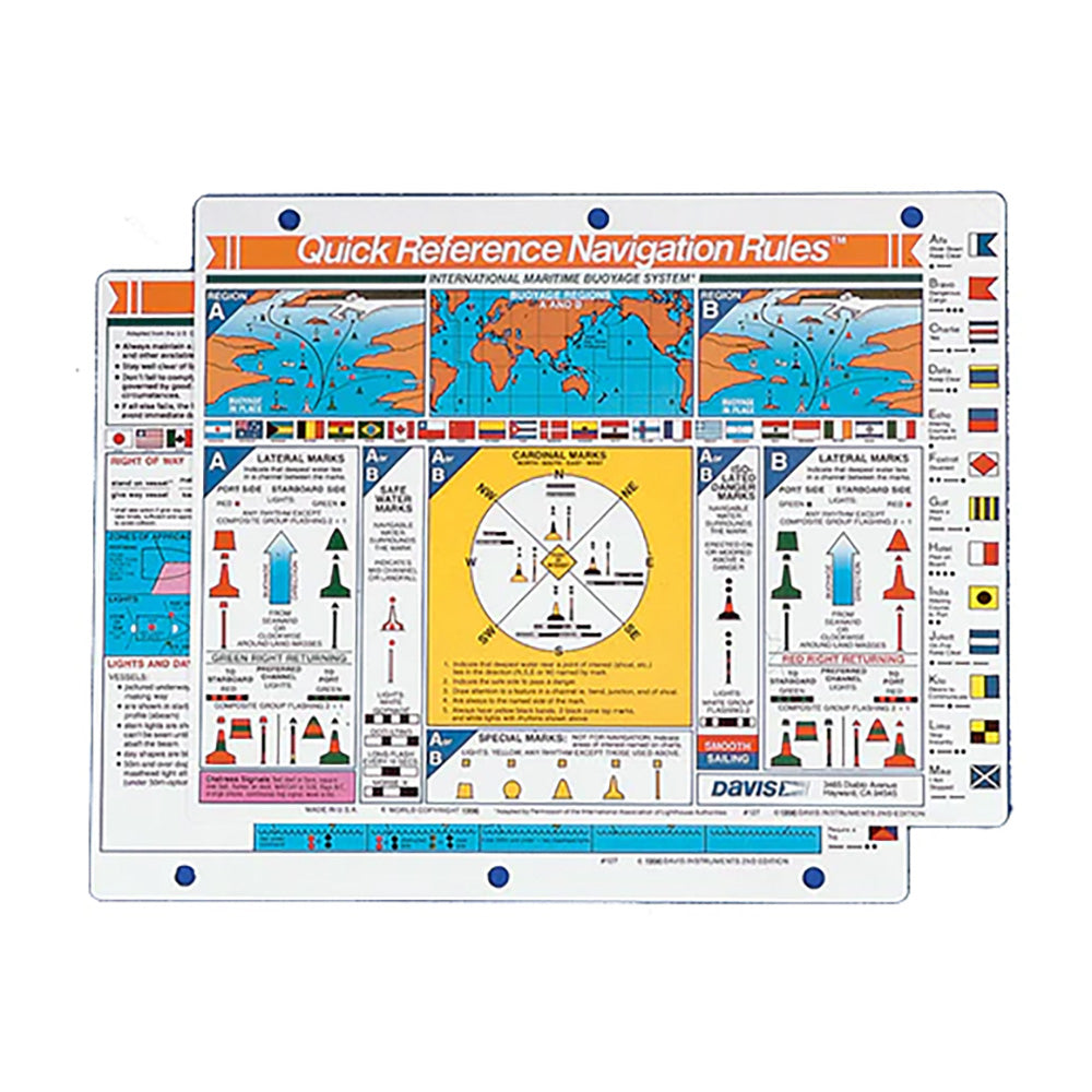
Davis Quick Reference International Navigation Rules Card
Davis Quick Reference International Navigation Rules Card is backordered and will ship as soon as it is back in stock.
Product Description
Product Description
The Quick Reference International Navigation Rules Card is an indispensable tool for every boater and mariner. This compact guide provides immediate access to essential navigation rules and systems, ensuring safe and compliant voyages through both familiar and uncharted waters.
Comprehensive Maritime Navigation Guide
This navigation card offers a thorough overview of key maritime regulations and practices, making it easier for boaters to stay informed and prepared. Whether you're a seasoned sailor or a weekend boater, this guide enhances your navigational competence and safety awareness.
International Maritime Buoyage System
Understand the standardized buoyage systems that facilitate safe navigation across global waterways. This section covers:
- Buoy Types: Detailed descriptions of lateral, cardinal, and special mark buoys.
- Color and Shape Coding: Explanation of buoy colors and shapes to signify different navigational messages.
- Buoyage Regions: Identification of areas governed by various buoyage systems to prevent confusion.
| Buoy Type | Color | Shape | Purpose |
|---|---|---|---|
| Lateral Mark | Red or Green | Can, Cone, or Spherical | Indicates the sides of a channel |
| Cardinal Mark | Yellow | Black and Yellow Diagonal Stripes | Marks the position of the safest water relative to the hazard |
| Special Mark | Various Colors | Distinctive Shapes or Symbols | Indicates special areas or hazards |
COLREGS Compliance
Adhere to the International Regulations for Preventing Collisions at Sea (COLREGs) with clear and concise guidelines:
- Right-of-Way Rules: Determine which vessel has priority in different navigational scenarios.
- Sound Signals: Learn the meanings of various horn blasts and whistles to communicate effectively.
- Lighting and Day Shapes: Identify navigation lights and day shapes to understand vessel movements and intentions.
Cardinal vs. Lateral Buoyage Systems
Clarify the differences between Cardinal and Lateral buoyage systems to navigate safely:
- Cardinal Buoyage: Indicates the direction of safe water relative to a hazard (North, East, South, West).
- Lateral Buoyage: Marks the sides of a navigable channel (red for port side, green for starboard side).
Buoyage Regions
Navigate confidently by understanding the specific buoyage regions:
- Coastal Waters: Areas near the shoreline with specific buoyage rules.
- Inland Waters: Rivers, lakes, and canals with distinct buoyage systems.
- International Waters: Open seas with universal buoyage standards.
Right-of-Way Rules
Ensure safe passage by mastering right-of-way rules:
- Overtaking: Rules governing vessels being overtaken.
- Meeting Head-On: Procedures to follow when two vessels approach each other head-on.
- Crossing Situations: Guidelines for vessels crossing paths at different angles.
Sound Signals for Safe Navigation
Enhance communication with standardized sound signals:
- One Short Blast: Indicates a vessel is altering its course to starboard.
- Two Short Blasts: Signals a vessel is operating astern propulsion.
- Three Short Blasts: Means a vessel is operating its engine in reverse.
Entering and Clearing Foreign Ports
Navigate international waters and foreign ports with confidence:
- Entry Procedures: Steps to follow when entering a foreign port.
- Clearance Requirements: Documentation and permissions needed for port entry and exit.
- Communication Protocols: Effective communication with port authorities and local vessels.
Lights and Day Shapes Identification
Identify and interpret navigation lights and day shapes to ensure vessel safety:
- Navigation Lights: Understanding the color, shape, and placement of lights for different vessel types.
- Day Shapes: Recognizing shapes displayed by vessels during daylight hours.
- Signal Interpretation: Decoding the meanings behind various light and shape signals.
Collision Prevention Procedures
Implement effective strategies to avoid maritime collisions:
- Maintaining Proper Lookout: Continuous vigilance to detect hazards early.
- Speed Management: Adjusting speed based on visibility, traffic, and conditions.
- Maneuvering Techniques: Executing safe turns and adjustments to navigate around obstacles.
Signal Flags Usage
Master maritime communication with signal flags:
- Flag Meanings: Learn the significance of individual flags and flag combinations.
- Proper Handling: Techniques for hoisting, positioning, and lowering flags correctly.
- Emergency Signaling: Using flags to convey distress or urgent messages.
Benefits for Boaters
By utilizing the Quick Reference International Navigation Rules Card, boaters can:
- Enhance Navigational Safety: Minimize risks by adhering to established rules and guidelines.
- Ensure Regulatory Compliance: Stay compliant with international maritime laws and standards.
- Prevent Collisions: Implement effective collision avoidance measures to protect lives and property.
- Boost Confidence: Navigate unfamiliar waters with assurance and expertise.
Delivery and Shipping
Delivery and Shipping
Orders of physical products placed by 3 PM EST M-F typically ships the same day, if all requested items are in stock. Weekend orders will typically ship on Monday.
Shipping takes 2-7 days.
We currently ship to the Contiguous 48 States.
Life of Sailing merch is custom made for the customer after an order is placed. Total turnaround is typically 7-14 days from order to doorstep.
Payment & Security
Payment methods
Your payment information is processed securely. We do not store credit card details.


